Stay up to date – you can subscribe to our newsletter here

While thousands of visitors flock daily to the famous waterfalls of Krka national park, just about 15 kilometers northwest of Skradin lies a place of almost magical tranquility: High above the small settlement of Bribir, at an elevation of 300 meters above sea level, rises the Bribirska Glavica plateau. Covering an area of 72,000 square meters—equivalent to about ten soccer fields—one of the most significant archaeological sites in Southeast and Central Europe stretches out here.
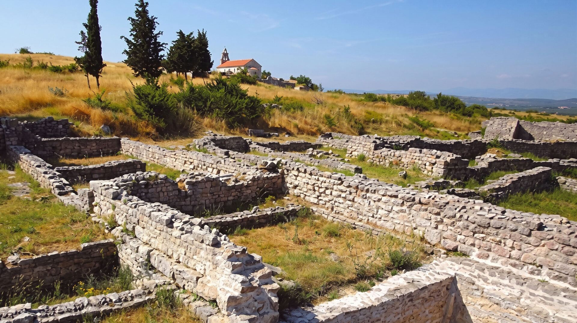
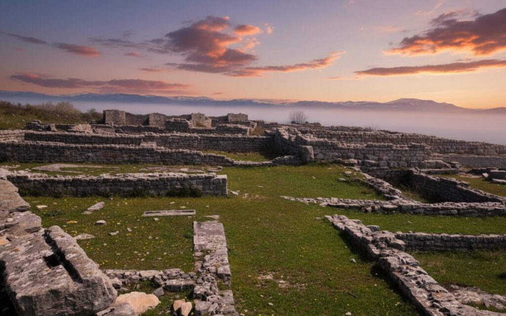
As you climb the hill, you suddenly find yourself in the midst of a stone labyrinth of massive Cyclopean walls, Roman cisterns, early Christian mosaics, and medieval palace ruins—with no ticket booths, turnstiles, or crowds of tourists.
In the foreground of the plateau, the exposed foundation walls from various centuries bear witness to the dense development of the former city, while in the background, nestled among the cypress trees, the small church of Saints Joachim and Anne marks the highest point of the hill:
Why “Croatian Troy”? A millennia-old stratigraphic model
Bribirska Glavica owes its evocative nickname “Croatian Troy” (Hrvatska Troja) to the Franciscan friar Fra Lujo Marun (1857–1939), the pioneer of Croatian national archaeology. When he began leading the first systematic excavations on the high plateau in 1908, he quickly recognized a fascinating parallel to ancient Troy in Asia Minor: Thanks to its strategically perfect location at the intersection of the fertile Ravni Kotari plain, the Krka River valley, and the trade routes to the Adriatic Sea, this hill was continuously inhabited for more than three millennia.
Each culture used the sheltered plateau as a fortress, building upon the foundation walls and ruins of its predecessors and thus leaving behind a unique archaeological stratigraphic record. On a walk through the site, you pass through all the key chapters of Dalmatian history in just a few hundred meters.

A Journey Through Time Across Five Epochs: The Layers of Bribir
- Prehistory and the Liburni Fortress (Bronze and Iron Ages): The first people settled here as early as the Eneolithic and Bronze Ages. In the 1st millennium B.C., the Illyrian tribe of the Liburni built a mighty hilltop settlement (Gradina). Their most visible legacy is the megalithic dry-stone walls on the edge of the plateau, which have survived to this day: Without mortar, the builders stacked precisely hewn limestone blocks weighing several metric tons on top of one another; these blocks still rise up to two meters high today.
- The Roman municipium of Varvaria (Antiquity): Following the Roman conquest in the 1st century B.C., the Liburnian hilltop settlement transformed into the thriving Roman city of Varvaria (later Varvarija). Under Emperor Augustus or Tiberius, the city was granted the status of a municipium with full Roman citizenship. The Romans reinforced the city wall, which was just over a kilometer long; they built a forum, residential quarters with underfloor heating, and a public nymphaeum featuring intricate floor mosaics; and they constructed a sophisticated system of large cisterns to store rainwater on the arid karst plateau.
- Late Antiquity and Early Christianity (5th to 6th centuries): Under Ostrogothic and Byzantine rule, Varvaria became a regional center of early Christianity. The remains of a multi-nave early Christian basilica, stone sarcophagi, and an architecturally rare rotunda (tetrakonchos) with four apses—which presumably served as a baptistery—date from this period.
- The Golden Age of the Middle Ages—The Power Base of the Šubić Princes (13th and 14th Centuries): Following the arrival of the Croats in the Early Middle Ages, Bribir rose to become the country’s most important political center in the 13th century. The plateau became the ancestral seat of the powerful Šubić noble family (Counts of Bribir). Under Ban Pavao I Šubić Bribirski (1245–1312)—the “uncrowned king of the Croats,” who ruled over large parts of Croatia, Dalmatia, and Bosnia—and even had his own coins minted—Bribirska Glavica served as the de facto capital of Croatia. Pavao I founded the Franciscan monastery and the Gothic Church ofSt. Mary (Crkva sv. Marije) on the plateau, which served as the family’s burial site. (A historical aside: In 1347, King Louis I of Anjou exchanged Bribir Castle for the Zrin Fortress in Slavonia—from then on, this branch of the family took the name Zrinski and went down in European history as one of the most famous noble dynasties.)
- Ottoman Outpost and Venetian Recapture (16th to 17th Centuries): In 1523, the fortress fell to the Ottoman Empire and served as a strategic frontier outpost for over 160 years. When Venetian troops and local allies recaptured Bribir in 1684 during the War of the Morea, the heavily damaged hilltop settlement lost its military significance. The inhabitants moved down into the sheltered valley—and, without realizing it, preserved the plateau as an untouched open-air museum.
What There Is to See on the Site Today
In addition to the sprawling ruins, city gates, and defensive towers, two intact buildings still stand on the high plateau today:
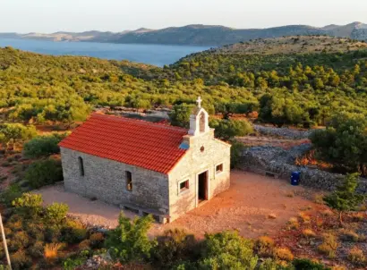
- The small Orthodox church of Saints Joachim and Anne (Crkva sv. Joakima i Ane), built on older foundations and picturesquely framed by dark cypress trees.
- The former school and guardhouse next door, which houses a small archaeological collection (usually open only by appointment or during ongoing excavation campaigns in the summer; the most significant original finds are on display at the Museum of Croatian Archaeological Monuments in Split and at the Šibenik City Museum).
- Along the loop trail, bilingual information panels (in Croatian and English) feature reconstruction drawings showing what the individual structures—from the Roman city gate to the Šubić family palace—once looked like.
Directions and Practical Tips for Your Visit
- Directions by car: From Skradin, follow the country road northwest through Dubravice and Rupe, or take State Road D56 (Skradin/Kistanje–Benkovac route) to the turnoff for the village of Bribir (travel time from Skradin is about 20 minutes; from Šibenik, about 35 minutes). In the village of Bribir, brown tourist signs (Bribirska Glavica) point to a narrow, winding road that turns into an easily drivable gravel road in the upper section and leads directly up to the plateau to a small parking lot. Alternatively, you can leave your car in the village and hike up in about 20 to 25 minutes.
- Admission & Hours: The entire area is free and open to the public 24 hours a day.
- Best time of day: Since there is hardly any shade on the 300-meter-high karst plateau, it can get extremely hot at midday in the height of summer. The ideal time to visit is early morning or late afternoon. Shortly before sunset, the soft light bathes the white limestone walls in warm golden hues, while the view stretches far across the fertile fields of Ravni Kotari all the way to the Velebit Mountains in the north.
- Equipment: Sturdy footwear is required on the uneven terrain with loose karst rocks. You should also bring plenty of drinking water, as there are no kiosks or restaurants on the plateau.
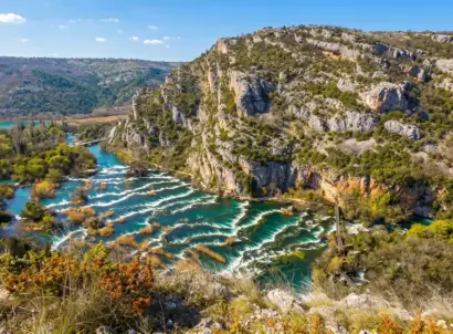
- Suggested itinerary: A detour to Bribirska Glavica can be perfectly combined with a visit to the quieter northern part of Krka national park (such as the Roški Slap waterfall or the monastery island of Visovac) as well as a wine tasting in the hinterland of Skradin, which is known for rare indigenous grape varieties such as Debit, Maraština, and Lasina.