Stay up to date – you can subscribe to our newsletter here

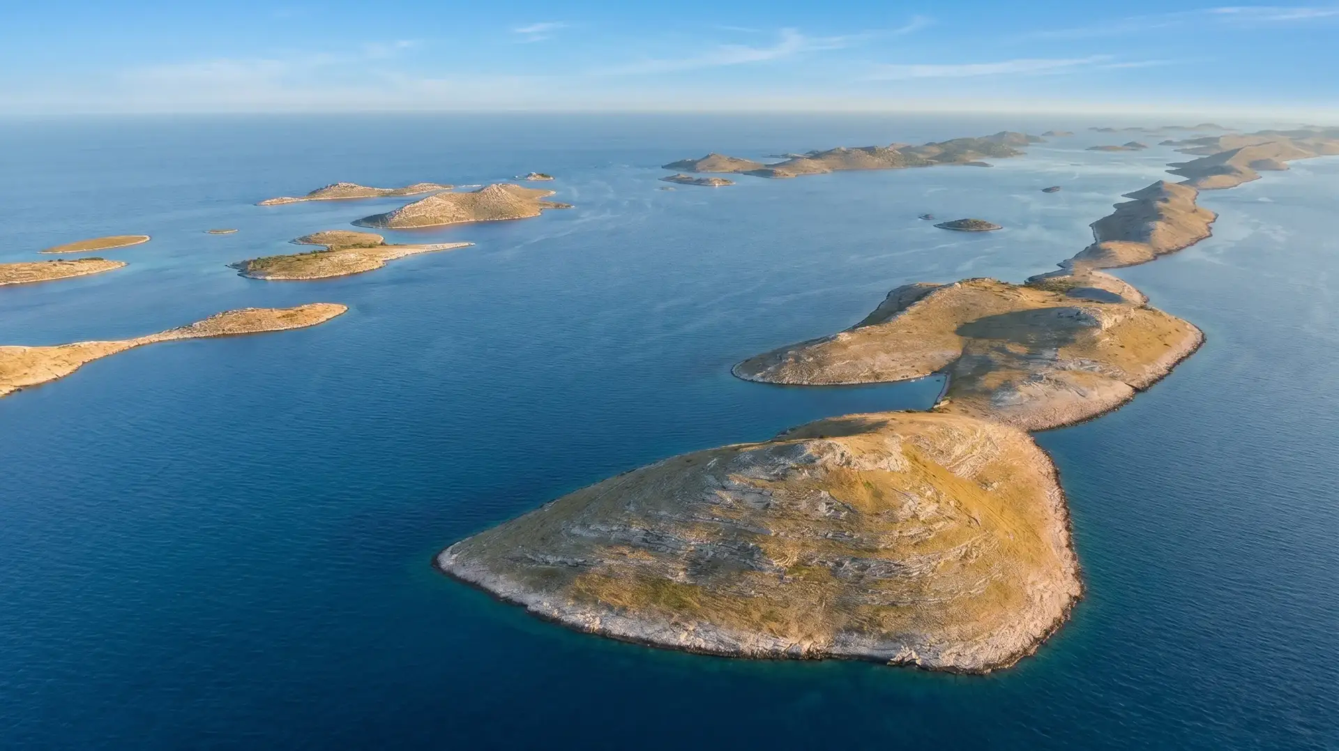
Anyone cruising through the Kornati national park glides through an almost surreal labyrinth of karst, limestone, and deep-blue water. Around 140 islands, islets, and reefs rise from the Adriatic Sea off the Dalmatian coast. A glance at the official nautical chart, however, reveals a curious detail: amid picturesque bays and secluded lighthouses, the area is teeming with place names that sound more like the names of rough-and-tumble harbor taverns than those of a venerable seafaring tradition.
The blame lies with a historical prank from the late 19th century—a clash between the imperial-royal obsession with rules and the dry humor of the local islanders, which dealt the Danube Monarchy what was probably its most risqué defeat.
When Viennese meticulousness meets Dalmatian summer heat
At the end of the 19th century, the court in Vienna decided to survey the entire empire anew and with precision, down to its furthest corners. Even the rugged coastline of Dalmatia was to be mapped in its entirety. So a contingent of dutiful Austro-Hungarian surveyors was sent south.
You have to picture the scene: there sat stiff officials from the distant metropolis, constricted in their high-necked uniform coats, armed with theodolites, clipboards, and unshakable seriousness, in the midst of the rocking wooden boats of the Kurnatari. That was the name given to the proud fishermen, shepherds, and landowners from the neighboring island of Murter, to whom the barren pastures and olive groves of the Kornati .
Communication was a disaster from the very beginning. The gentlemen from Vienna spoke hardly a word of Croatian—and certainly not the Kurnatari island dialect, which was heavily influenced by Venetian and Old Slavic expressions. Moreover, the merciless summer sun beat down on the white cliffs, while sweat trickled down beneath their official caps.
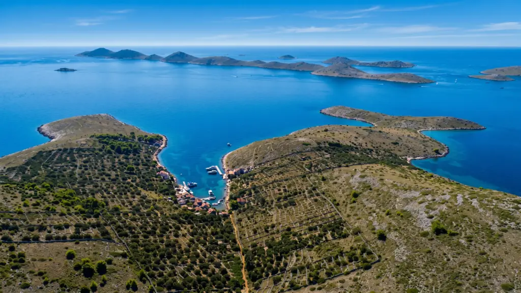

“And what’s this pile of rocks called?” – The Birth of a Roguelike
To the locals, many of the tiny, waterless reefs were simply nameless rocks in the sea that one should avoid running aground on at all costs. But for the imperial bureaucracy, there could be no blank spots on the map. Every pile of rocks, no matter how small—barely big enough for two seagulls to perch on—needed a proper name for the land registry office.
Day after day, the men from Murter rowed the impatient officials from reef to reef. And each time, the same routine played out: The surveyor would point his finger at a barren cliff, gaze sternly over his glasses, and demand to know its name.
At some point, the Kurnatari lost their patience—or rather, their mischievous side took over. Annoyed by the condescending manner of their high-and-mighty visitors, who wanted to know everything in excruciating detail, the boatmen decided to give the eager scribes exactly what they were asking for. With dead-serious expressions and reverent nods, they began dictating wonderfully obscene names—entirely made up—in a broad dialect.
The Naughtiest Atlas in World History
While the fishermen were inwardly doubled over with laughter, the imperial geographers carefully transcribed every syllable into their field notebooks with calligraphic precision. Thus, the rocks and islands were given names that would never have been uttered in any respectable Viennese salon:
- Babina Guzica (“Grandma’s Butt”): A rounded, two-part rocky islet whose silhouette apparently particularly captured the imagination of sailors.
- Kurba Vela and Kurba Mala (“Big Whore” and “Little Whore”): Although linguists suspect that “Kurba” originally derived from the Latin “curva” (referring to the island’s elongated, curved shape) —but for the Kurnatari, the similarity to the Croatian word for a woman of the night came in handy, allowing them to provide the Viennese officials with a pair of names: a “big” and a “small” version.
- Prduša Vela and Prduša Mala (“The Big Fart” and “The Little Fart”): Two barren islands whose names suggest that the exhausted rowers had finally run out of poetic inspiration.
None of the surveyors suspected anything. They politely thanked him for the information, closed their books, and, their work done, returned contentedly to the capital.
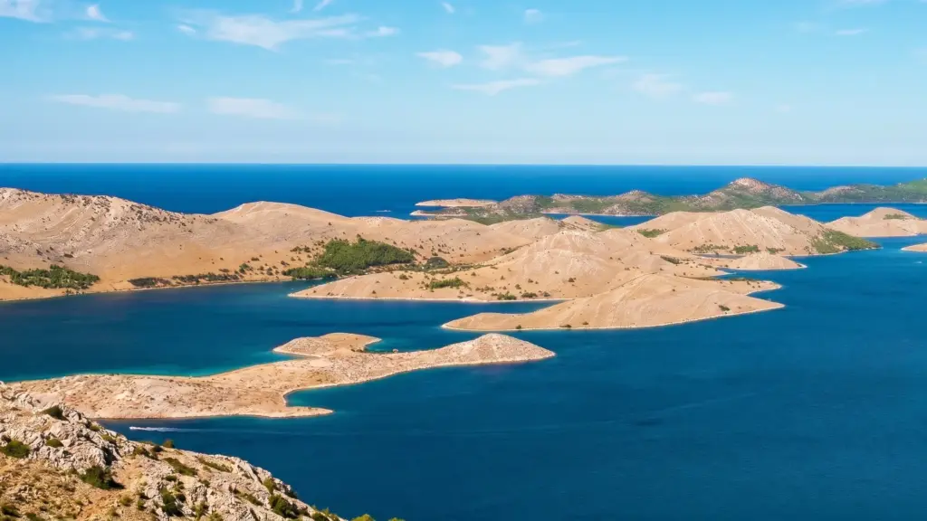
Lèse-majesté on handmade paper
In Vienna, things proceeded in their usual official manner. The records were examined, engraved by copper engravers onto the finest printing plates, printed on fine paper, and finally authenticated with the imperial and royal seal. The monarchy had now officially and by the highest authority incorporated “Grandma’s Butt” and “The Big Fart” into its imperial territory.
It took years before bilingual naval officers and administrative officials, upon closer inspection, realized what was actually written in cursive on the imperial nautical charts. The embarrassment at court was complete, but there was little that could be done to undo the blunder: Thousands of copies of the charts had long since been in circulation within the Navy and the merchant marine.
On the island of Murter and in the taverns along the coast, however, the story became part of the enduring folk tradition. For decades, people there would slap their thighs in laughter at the “stupid surveyors from Vienna” who had taken every curse at face value. And because such a brilliant testament to peasant wit cannot simply be erased, Babina Guzica, Kurba Vela, and Prduša Vela still appear exactly as they are on every official Croatian nautical chart—as an eternal salute from the proud Kurnatari to the imperial bureaucracy.